Forests: Flying Drones for the Trees
Special | 6m 49sVideo has Closed Captions
Learn about the latest technology used to manage forest land.
Land managers have turned to a new technology to help them manage forests. Meet two remote sensor technicians who help catalog the state of Idaho’s public forests using drones.
Problems playing video? | Closed Captioning Feedback
Problems playing video? | Closed Captioning Feedback
Science Trek is a local public television program presented by IdahoPTV
Major Funding by the Laura Moore Cunningham Foundation and the Idaho National Laboratory. Additional Funding by Sparklight, the Friends of Idaho Public Television and the Corporation for Public Broadcasting.
Forests: Flying Drones for the Trees
Special | 6m 49sVideo has Closed Captions
Land managers have turned to a new technology to help them manage forests. Meet two remote sensor technicians who help catalog the state of Idaho’s public forests using drones.
Problems playing video? | Closed Captioning Feedback
How to Watch Science Trek
Science Trek is available to stream on pbs.org and the free PBS App, available on iPhone, Apple TV, Android TV, Android smartphones, Amazon Fire TV, Amazon Fire Tablet, Roku, Samsung Smart TV, and Vizio.
Science Trek
Science Trek is a place where parents, kids, and educators can watch short, educational videos on a variety of science topics. Every Monday Science Trek releases a new video that introduces children to math, science, technology, engineering, and math (STEM) career potentials in a fun, informative way.More from This Collection
The environment is where we live. It is where all the animals, insects, plants and other living things make their place in the world. It is everything that makes up our surroundings including the air we breathe, the water we drink and the land we live upon. Scientists study many different parts of the environment to learn how these systems work. Learn more about the environment.
Yellowstone: Secrets Beneath Yellowstone
Video has Closed Captions
What are Yellowstone National Park's five types of thermal features? (7m 34s)
Yellowstone: A Most Unusual Neighborhood
Video has Closed Captions
Yellowstone National Park is unlike anywhere else on Earth. (8m 14s)
Weather: Meteorologists At Work
Video has Closed Captions
How do meteorologists forecast the weather? (5m 13s)

Deserts: Cacti, Bees and the Sonoran Desert
Video has Closed Captions
How do Saguaro Cacti survive in the desert? (6m 23s)
Sewage: Sewage Through the Ages
Video has Closed Captions
What shouldn’t you put down the drain or flush away? (5m 59s)


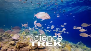
Oceans: What's Under the Surface?
Video has Closed Captions
Oceans cover 70% of the Earth’s surface. Find out more about what’s under the surface. (7m 4s)
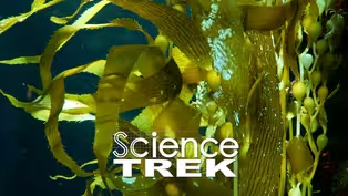
Oceans: Saving Kelp with AI and ROV
Video has Closed Captions
How do you use AI, ROV and an x-box joystick to save kelp? (6m 50s)
Providing Support for PBS.org
Learn Moreabout PBS online sponsorshipJOAN CARTAN-HANSEN, HOST: The state of Idaho owns and manages about a million acres of forest lands.
But how do they keep track of all those trees?
One way is to use a high-tech bird's-eye view.
(MUSIC) GEOFF KLINE, REMOTE SENSING PROJECT: This is one of those sites (pickup tailgate opening) we never picked up in the Kootenai County project.
TRAVIS DAVIS, REMOTE SENSING TECHNICIAN: Yup.
(Sound of platform being pulled out) CARTAN-HANSEN: Geoff Kline is the remote sensing project manager for the Idaho Department of Lands.
KLINE: I'll set up the GPS.
CARTAN-HANSEN: And Travis Davis is a remote sensing technician.
DAVIS: I'll set the overlap to probably 50 percent.
That should give us good penetration down to the ground cover.
CARTAN-HANSEN: The remote sensing team has a big job to do.
They are building a three-dimension computer model of about a million acres of state-owned timber lands.
KLINE: Historically, it was difficult to keep tabs on exactly what is on that much ground cuz you can't be out there all the time.
And a lot of the areas are really remote.
In the past, you would go out and collect a series of small plots, literally send somebody out to measure the height of a tree, how wide the tree is, what type of tree it was, um, and things of that sort.
CARTAN-HANSEN: Today, they're using specialized drones.
(Sound of drone taking off) KLINE: And this technology is changing the way we look at managing and keeping track of our forests because you actually have the ability to use powerful computers and have all that information right at your fingertips for wall to wall, every piece of ground that we own, (sound of drone) KLINE: So, as soon as the weather is, starting to warm up and the snow's starting to get off the ground in the spring, our field season gets going real fast.
We do a number of things in the field.
One is we have a lot of data collection, which is where we use the drones, and we also have contractors who fly manned aircraft.
And then we also spend a lot of time validating the data and, and collecting information about the trees in the field that we use to train the models that tell us how many trees are out in the woods and how tall they are and things of that sort, what species they are.
CARTAN-HANSEN: The department also uses satellite images and video shot from aircraft, but using drones for land management is less expensive.
And there's another plus.
DAVIS: The image quality and the footage and the data that you get from the drones is so much more precise than what we could get from satellite imagery.
And so, it in turn makes uh, any of the data that we get a lot better.
CARTAN-HANSEN: The drones use LIDAR to collect data.
KLINE: So, LIDAR, it's an acronym.
L I D A R, it stands for light detection and ranging.
And what it does is it creates really detailed 3D models.
The sensor is very expensive and highly calibrated, but at the end of the day, all it is a really accurate, detailed 3D model.
So that when you look at it on a computer screen or a tv, it almost just looks like you're looking at a video of the place you were just at.
CARTAN-HANSEN: These drones can also help land managers track tree health over time and give vital information to wild land fire fighters.
KLINE: We have thermal cameras that'll show the heat signature of the ground.
So even if something is underneath the ground and is still smoldering or still kind of burning, still capable of burning, if the wind picked up and really got some flames going, um, it'll pick up that heat and we can look right along the edges of where the fire had burned but now appears to be out.
And if we find areas of smoldering around the edge, we can mark those from a computer as the drones flying around and create maps to tell firefighters exactly where to go check the ground for heat.
CARTAN-HANSEN: So, the team spends the summer doing field work.
KLINE: And then as we transition into winter, we have piles of data and piles of plots, and then we just start crunching numbers.
It took about five years to map it all.
The drones have been key for particularly isolated areas.
And then we also use manned aircraft to fly several million acres at a time working with other government agencies and large timber owners to cooperatively collect this 3D information throughout the state.
CARTAN-HANSEN: So, why do all this?
KLINE: We make money off trees.
Trees make the wood we use to build houses and we're able to sell those trees and all of that money for the state land that we get from selling the trees on that state land goes towards Idaho schools, Idaho public schools.
So, that's a big one for us.
CARTAN-HANSEN: Both Klein and Davis enjoy their job.
They get to work with the latest technology and.
DAVIS: The coolest part of the job is just being able to get out and see pretty much incredible things on the endowment, lands, things that I normally wouldn't be able to see on my own.
CARTAN-HANSEN: Managing Idaho state lands is important and not just for the timber sales.
These forests are a great place to recreate.
And they play an important role in our ecosystem.
KLINE: All of our fresh drinking water and everything, you imagine all that water flowing down from the mountains.
Well, these mountains are where all our, our forests and trees are and that's where a lot of the state land is.
And so, we take a lot of pride in keeping it healthy and clean and a nice place to go visit.an.
CARTAN-HANSEN: If you want to learn more about forests, check out the Science Trek website.
You'll find it at ScienceTrek.org.
(MUSIC) ANNOUNCER: Presentation of Science Trek on Idaho Public Television is made possible through the generous support of the Laura Moore Cunningham Foundation, committed to fulfilling the Moore and Bettis family legacy of building the great state of Idaho.
By the Idaho National Laboratory, mentoring talent and finding solutions for energy and security challenges, by The Friends of Idaho Public Television and by the Corporation for Public Broadcasting.
Video has Closed Captions
Clip: Special | 1m 4s | What animals can you find in the understory? (1m 4s)
Video has Closed Captions
Clip: Special | 1m 4s | Learn how trees defend themselves. (1m 4s)
Providing Support for PBS.org
Learn Moreabout PBS online sponsorship
- Science and Nature

Explore scientific discoveries on television's most acclaimed science documentary series.

- Science and Nature

Capturing the splendor of the natural world, from the African plains to the Antarctic ice.


Support for PBS provided by:
Science Trek is a local public television program presented by IdahoPTV
Major Funding by the Laura Moore Cunningham Foundation and the Idaho National Laboratory. Additional Funding by Sparklight, the Friends of Idaho Public Television and the Corporation for Public Broadcasting.